NextCloud : Passage en version 27.0.1

En passant

Pas de problème à noter, j’ai du lancer une commande en ligne :

# sudo -u www-data php /usr/share/nginx/nextcloud/occ  db:add-missing-indices
Check indices of the share table.
Check indices of the filecache table.
Adding additional parent index to the filecache table, this can take some time...
Filecache table updated successfully.
Check indices of the twofactor_providers table.
Check indices of the login_flow_v2 table.
Check indices of the whats_new table.
Check indices of the cards table.
Check indices of the cards_properties table.
Check indices of the calendarobjects_props table.
Check indices of the schedulingobjects table.
Check indices of the oc_properties table.
Check indices of the oc_jobs table.
Check indices of the oc_direct_edit table.
Check indices of the oc_preferences table.
Check indices of the oc_mounts table.
Adding mounts_user_root_path_index index to the oc_mounts table, this can take some time...
oc_mounts table updated successfully.
Check indices of the oc_systemtag_object_mapping table.
Adding systag_by_tagid index to the oc_systemtag_object_mapping table, this can take some time...
oc_systemtag_object_mapping table updated successfully.
Adding additional textstep_session index to the oc_text_steps table, this can take some time...
oc_text_steps table updated successfully.


BiotInfo : Des vélos et pas de piste … misère.

Dans le dernier Biot Info j’ai pu voir cet article :

Quand on regardes le plan vélo 2028 : https://www.departement06.fr/grands-projets-2021-2028/plan-velo-2028-faciliter-la-pratique-du-velo-pour-tous-43426.html

C’est pas demain que l’on va avoir une piste le long de la Brague …

Misère.

Randonnées : Le Pra – Lac de Vens – Cime de Borgonio (2030m)

Le parcours à faire sur 2 jours (le mieux) :

Etape 1 :

Total distance: 9251 m
Max elevation: 2430 m
Min elevation: 1651 m
Total climbing: 895 m
Total descent: -220 m
Average speed: 3.54 km/h
Total time: 03:02:37
Download file: LePraLacVens.gpx


Etape 2 :

Total distance: 3641 m
Max elevation: 2921 m
Min elevation: 2373 m
Total climbing: 632 m
Total descent: -85 m
Average speed: 2.51 km/h
Total time: 02:04:43
Download file: CimeBorg.gpx


Etape 3 : Le plus rapide mais 2 km de route sur la fin.

Total distance: 9618 m
Max elevation: 2376 m
Min elevation: 1552 m
Total climbing: 204 m
Total descent: -929 m
Average speed: 5.45 km/h
Total time: 02:00:23
Download file: RetourLePra.gpx


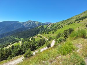
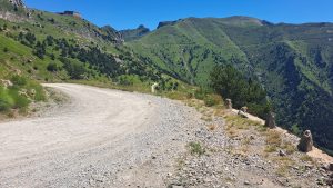
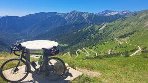
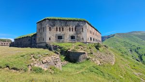
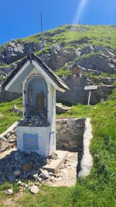
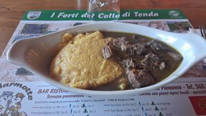
Quelques photos :

Linux/Python : Merge d’un GPX et d’une video

Etape 1 : Installation : https://pypi.org/project/gopro-overlay/

$ python3 -m venv venv
$ venv/bin/pip install gopro-overlay
$ mkdir ~/.gopro-graphics/
$ cat ~/.gopro-graphics/ffmpeg-profiles.json
{
  "overlay": {
    "input": [],
    "output": ["-vcodec", "png"]
  }
}

Etape 2 : Premier test et premier drame

$ venv/bin/gopro-dashboard.py --use-gpx-only --gpx Nextcloud/Pipe/Video/BoucleResideo.gpx 1920x1080 Nextcloud/Pipe/Video/BoucleResideo.mov 
Starting gopro-dashboard version 0.100.0
ffmpeg version is 4.4.2-0ubuntu0.22.04.1
Using Python version 3.10.6 (main, May 29 2023, 11:10:38) [GCC 11.3.0]
Traceback (most recent call last):
  File "/home/arias/venv/bin/gopro-dashboard.py", line 107, in 
    font = load_font(args.font)
  File "/home/arias/venv/lib/python3.10/site-packages/gopro_overlay/font.py", line 5, in load_font
    return ImageFont.truetype(font=font, size=size)
  File "/home/arias/venv/lib/python3.10/site-packages/PIL/ImageFont.py", line 1008, in truetype
    return freetype(font)
  File "/home/arias/venv/lib/python3.10/site-packages/PIL/ImageFont.py", line 1005, in freetype
    return FreeTypeFont(font, size, index, encoding, layout_engine)
  File "/home/arias/venv/lib/python3.10/site-packages/PIL/ImageFont.py", line 255, in __init__
    self.font = core.getfont(
OSError: cannot open resource

Etape 2b : Avec copie de la « font »

$ venv/bin/gopro-dashboard.py --use-gpx-only --gpx Nextcloud/Pipe/Video/BoucleResideo.gpx --overlay-size 1920x1080 Nextcloud/Pipe/Video/BoucleResideo.mov --font Nextcloud/Pipe/Video/Roboto-Medium.ttf 
Starting gopro-dashboard version 0.100.0
ffmpeg version is 4.4.2-0ubuntu0.22.04.1
Using Python version 3.10.6 (main, May 29 2023, 11:10:38) [GCC 11.3.0]
GPX/FIT file:     2023-07-05T17:51:34+00:00 -> 2023-07-05T18:02:30+00:00
Timer(loading timeseries - Called: 1, Total: 2.99467, Avg: 2.99467, Rate: 0.33)
Generating overlay at Dimension(x=1920, y=1080)
Timeseries has 6561 data points
Processing....
Timer(processing - Called: 1, Total: 4.25000, Avg: 4.25000, Rate: 0.24)
FFMPEG Output is in /tmp/tmpkga_2k5h
Timelapse Factor = 1.000
Layout -> Include component 'date_and_time' = True
Layout -> Include component 'gps_info' = True
Layout -> Include component 'gps-lock' = True
Layout -> Include component 'big_mph' = True
Layout -> Include component 'gradient_chart' = True
Layout -> Include component 'gradient' = True
Layout -> Include component 'altitude' = True
Layout -> Include component 'temperature' = True
Layout -> Include component 'cadence' = True
Layout -> Include component 'heartbeat' = True
Layout -> Include component 'moving_map' = True
Layout -> Include component 'journey_map' = True
Executing 'ffmpeg -hide_banner -y -hide_banner -loglevel info -f rawvideo -framerate 10.0 -s 1920x1080 -pix_fmt rgba -i - -r 30 -vcodec libx264 -preset veryfast Nextcloud/Pipe/Video/BoucleResideo.mov'
...

Etape 3 : Shotcut : https://shotcut.org/